Overview
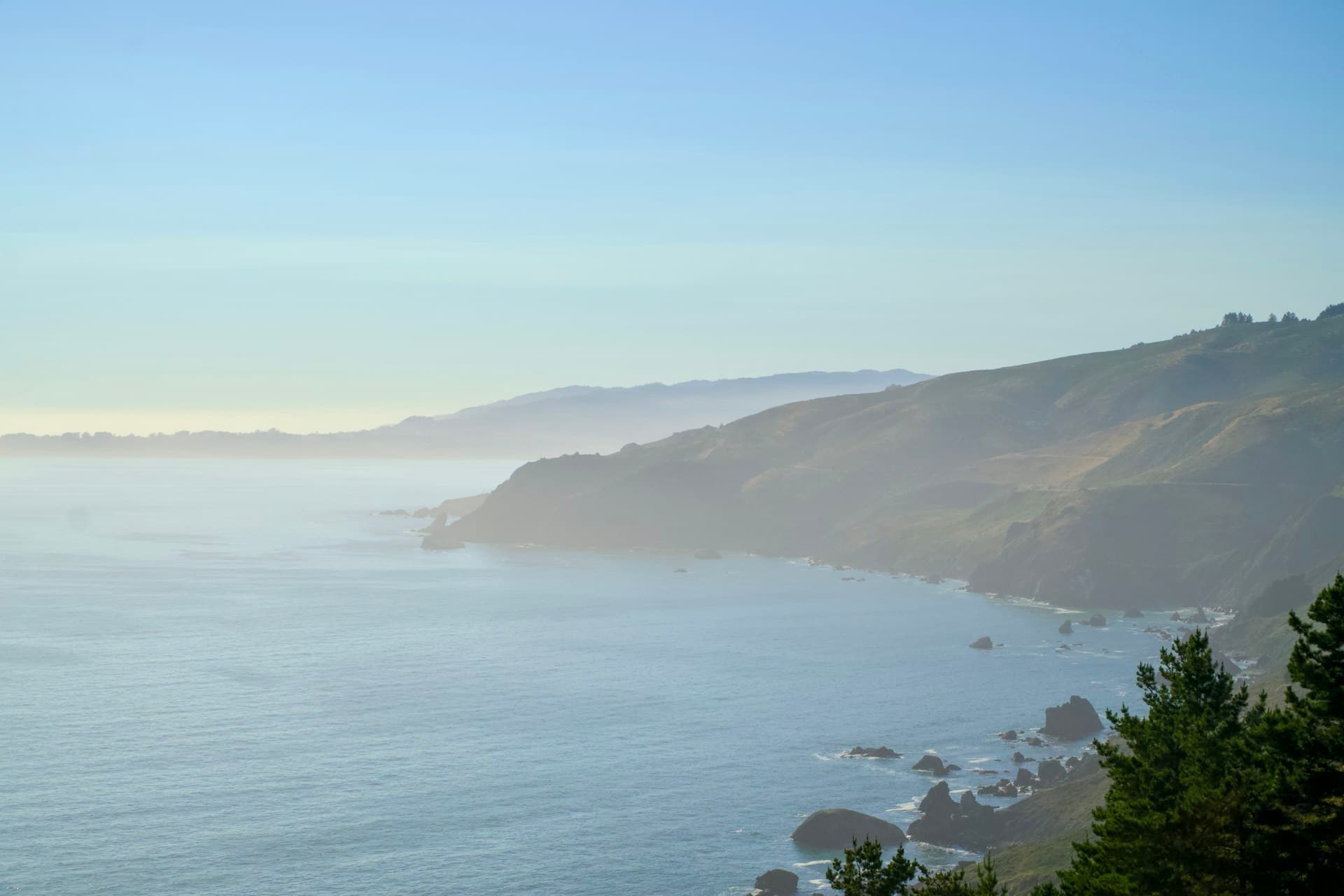
Windy Hill earns its name — this Peninsula ridgeline sits at 1,900 feet with consistent wind that makes kite flying close to effortless, and panoramic views that span the Santa Cruz Mountains, San Francisco Bay, and on clear days the Pacific Ocean. It's 1,300 acres of open grassland and oak woodland managed by the Midpeninsula Regional Open Space District, free to enter, and genuinely uncrowded outside of spring weekends. The drive up Skyline Boulevard (Highway 35) is part of the deal.
How to Do It
There are two main Skyline Boulevard trailheads. The Spring Ridge Trailhead has about 10 roadside spaces and sits at the Spring Ridge Trail starting point — this is the better one for kite flying because there's flat open grassland right off the parking area and picnic tables adjacent. The Picnic Area/Anniversary Trailhead is about a quarter mile north with 11 spaces (plus one ADA) and has a bathroom. From Highway 280, take Highway 84 west to Skyline Boulevard, turn left, and drive 2.3 miles south — the Spring Ridge lot is on your left. For the summit, the Anniversary Trail is 0.6 miles between the two parking areas with a short detour to the top. The full Windy Hill Loop via the Spring Ridge, Hamm's Gulch, Lost, and Anniversary trails runs about 8 miles — beautiful but a full day for a family. For a kid-paced day, go straight to the Spring Ridge area, fly the kite, eat lunch at the picnic tables, and do the Anniversary Trail to the summit and back.

Tips & Tricks
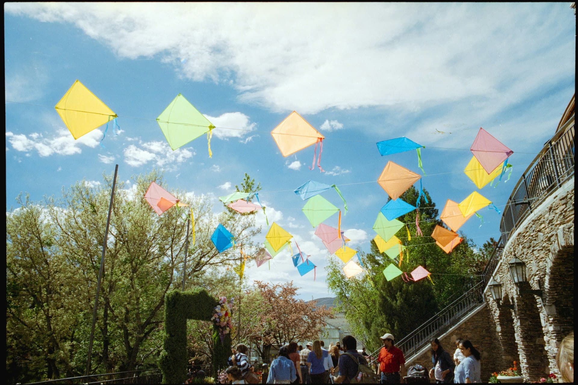
Bring a real kite, not a cheap delta from a drug store. The wind here is consistent and sometimes strong — a frame that can handle 15-20 mph gusts (nylon ripstop with fiberglass rods) will stay in the air without drama. Delta or diamond styles work best; box kites get pulled hard. Bring at least 100 feet of line.
The grasslands get hot in summer and the exposed ridge has zero shade. Sunscreen, hats, and water for everyone before you leave the car — once you're out on the open grass it's relentless sun. Two quarts of water per person for anything more than an hour out.
Watch for rattlesnakes, particularly on warm days in spring and summer when the trails are baking. They're common in this area. Keep kids on established trails and away from rock piles and tall grass. Poison oak lines many of the wooded sections of trail — if you go beyond the open grassland into the oak woodland, teach kids to identify and avoid it.
Spring (March through May) is the peak for wildflowers across the open meadows — lupine, poppies, and blue-eyed grass in waves. Fall (October and November) is the best window for clear air and long views after summer fog clears. Summer mornings work if you're out by 9am before the heat builds. Winter trails can be muddy after rain and parking fills early on dry weekends.
The Lost Trail, which runs roughly south along Skyline, is the least demanding route in the preserve — mostly single-track through oak woodland with gentle elevation and good shade. For families with kids 5-6 who aren't ready for the exposed ridge, this is a better starting hike. The Sausal Pond Loop (1.5 miles, 236 feet elevation) is another solid option that passes through oak woodlands and open meadows without the full ridge exposure.
Planning
Free entry, no reservation, no parking fee. No facilities at the Spring Ridge lot — the nearby Picnic Area lot has a portable restroom. Bring everything you need: water, sunscreen, snacks, layers for wind. The ridgeline is reliably 10-15 degrees cooler and windier than the valley below, even on warm days — wind layers for kids matter. Best ages are 4-8 who can handle a mile or two of hiking; toddlers are tough here given no stroller access and exposed terrain. Dogs are allowed on-leash. No bikes on the narrow single-track trails, though fire roads are open to mountain bikes. Best months are March through May and October through November. Avoid after heavy rain when trails turn muddy and creek crossings get tricky.